
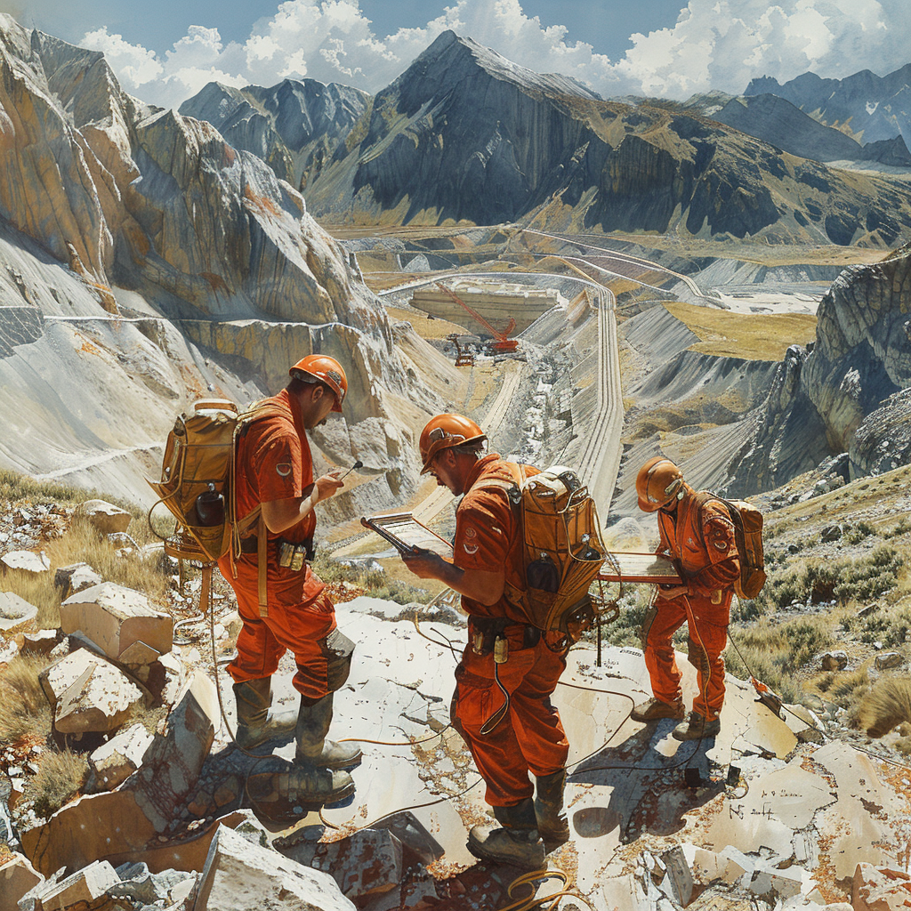
Green Masters specializes in providing high-quality LiDAR point clouds and 3D modeling services utilizing cutting-edge technology. We combine drones, LiDAR, and point cloud photogrammetry to capture detailed data, creating precise three-dimensional models of various environments.
These technologies allow us to conduct rapid surveys, encompass large projects with meticulous detail and accuracy, all while maintaining a minimal margin of error.
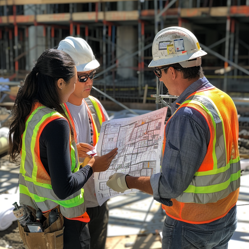
Drone-Based Property and Land Topographic Surveys
By engaging our Drone-Based Property and Land Topographic Survey service, our clients efficiently gain detailed measurements. Topographic evaluation and site analysis enable precise measurements and comprehensive geographic data. This facilitates the effective planning of surveying, construction, and development projects.
Discover how you can save money by utilizing our services. Contact us today for more information and to request a no-obligation quote.
LiDAR Point Cloud Building and Object Survey Service
LiDAR technology captures millions of points per second, generating high-density point clouds with millimeter-level precision that provide accurate information about the geometry of buildings and objects. Additionally, it enables the creation of high-quality, true-to-scale 3D realistic models that faithfully represent reality.
LiDAR technology offers precise and error-free information, increasing data reliability. This allows us to make informed and accurate decisions during the design and construction process. Additionally, it facilitates the identification of details such as windows, doors, cornices, and other architectural elements.
Being a fast and efficient process, it significantly reduces field work time while enabling the capture of large areas in a short time, making it ideal for large-scale projects.
This innovative technology has a wide range of applications in various sectors, including civil engineering, appliance manufacturing, design and architecture, geotechnical engineering, construction, the automotive industry, and archaeology. Below, we will explore the benefits this technology has brought to various real-world sectors or projects:
CIVIL ENGINEERING PROJECTS
Key Benefits
Enhanced Planning and Design
LiDAR point clouds provide civil engineers with a precise and detailed representation of the terrain, existing structures, and site features. This enables more accurate planning and design, reducing errors, costs, and project delays.
Reduced Errors and Costs
Rapid and precise data capture with LiDAR surveying eliminates the need for slower and more expensive traditional surveying methods. Additionally, the detailed information from point clouds allows for optimized designs, minimized material waste, and improved construction efficiency.
Enhanced Communication and Collaboration
LiDAR point clouds serve as a shared 3D data repository that facilitates communication and collaboration among different project teams, including engineers, architects, contractors, and owners. This reduces miscommunication, streamlines decision-making, and ensures better alignment among stakeholders.

APLICACIONES EN LA INGENIERIA CIVIL
Highway and Freeway Planning
LiDAR point clouds are employed to generate high-quality, accurate 3D terrain models, enabling engineers to plan efficient routes, assess environmental impact, and design effective drainage systems.
Bridge and Tunnel Construction
LiDAR technology is utilized to inspect the condition of existing bridges and tunnels, identify potential structural flaws, and plan repairs or replacements. It is also employed in the design and construction of new bridges and tunnels, ensuring precision and structural integrity.
Urban Infrastructure Development
LiDAR point clouds are used to plan and design urban infrastructure projects, such as sewer systems, water supply networks, and electrical grids. The precise information of the terrain and existing features allows for the optimization of the design and placement of these infrastructures.
SUCCESS STORY EXAMPLES
Crossrail Tunnel in London
LiDAR point clouds were utilized to create a high-quality 3D model of the subsurface, enabling engineers to precisely plan the tunnel route and avoid underground obstacles. This saved time, money, and reduced project risks.
Golden Gate Bridge in San Francisco
LiDAR point clouds were employed to inspect bridge components during fabrication, allowing for early identification and correction of dimensional errors. This reduced rework costs and project delays.
Colosseum Restoration in Rome
LiDAR point clouds were used to create a detailed 3D model of the monument, facilitating communication and collaboration among the different teams of architects, engineers, and contractors. This ensured a high-quality final outcome faithful to the original structure.
FABRICACIÓN DE ELECTRODOMÉSTICOS
Key Benefits
Precise Quality Control
LiDAR point clouds provide appliance manufacturers with a precise and efficient method for inspecting the dimensions and geometry of parts and components. This allows for early identification and correction of dimensional defects in the production process, reducing the rate of defective products and improving overall quality.
Reverse Engineering
LiDAR point clouds can be utilized to create detailed 3D models of existing parts and components. These high-quality 3D models serve as a foundation for reverse engineering, enabling manufacturers to redesign, modify, or create replacement parts for discontinued or hard-to-source products.
Manufacturing Process Optimization
LiDAR surveying can be employed to analyze and optimize manufacturing processes, identifying bottlenecks, improving workflow efficiency, and reducing material waste.

APPLICATIONS IN APPLIANCE MANUFACTURING
Part and Component Inspection
LiDAR point clouds can be utilized to inspect the dimensional quality of appliance casings, metal parts, electronic components, and elements. The precision of point clouds allows for the detection of minute deviations and defects that could impact the functionality or aesthetics of the final product.
Assembly Analysis
LiDAR point clouds are employed to analyze the fit and alignment of parts during the assembly process. This enables early problem identification and corrective action to ensure the quality of the final product.
Dimensional Control of Tools and Robots
LiDAR point clouds are used to verify the dimensional accuracy of tools and robots utilized in manufacturing. This ensures that tools and robots are properly calibrated and that produced parts meet design specifications.
SUCCESS STORY EXAMPLES
Bosch Factory in Stuttgart, Germany
LiDAR point clouds are utilized to inspect the quality of washing machine casings. This has reduced the defect rate by 5% and improved customer satisfaction.
Samsung Electronics
LiDAR point clouds are employed to create high-quality 3D models of existing electronic components. This has accelerated the product development process and reduced design costs by 10%.
General Motors Factory in Detroit, USA
LiDAR point clouds are used to optimize robotic welding processes. This has reduced material waste by 8% and improved weld quality.
ARCHITECTURAL PROJECTS
Key Benefits
High-Quality 3D Model Creation
LiDAR point clouds provide a precise and complete 3D data repository of an existing building or site. This enables architects and designers to create detailed 3D models that accurately reflect the dimensions, geometry, and characteristics of the space.
Visualization and Simulation
High-quality 3D models generated from LiDAR point clouds can be utilized to create realistic visualizations and simulations of the project. This allows clients, architects, and other stakeholders to see how the finished project will look, facilitating decision-making and reducing the risk of costly changes in later stages.
Precise Documentation
LiDAR point clouds provide precise and comprehensive documentation of the current state of a building or site. This is essential for renovation, restoration, and historic preservation projects, as it enables professionals to document the building’s current condition and plan interventions that are accurate and respectful of the site’s history.

APPLICATIONS IN DESIGN AND ARCHITECTURE PROJECTS
Surveying Existing Buildings
LiDAR point clouds are used to create high-quality 3D models of existing buildings, even those with complex structures or irregular geometries. This enables architects and designers to conduct accurate assessments of the building’s condition, plan renovations and expansions, and create precise documentation for conservation purposes.
Designing New Spaces
High-quality 3D models generated from LiDAR point clouds can be utilized to design new spaces within existing buildings. This allows architects and designers to evaluate the available space, verify compatibility with the existing structure, and create designs that integrate harmoniously with the surroundings.
Historic Heritage Documentation
LiDAR point clouds are employed to create precise and detailed documentation of historical sites and monuments. This enables conservators to document the current state of these sites, plan conservation and restoration interventions, and create high-quality 3D models for educational and research purposes.
SUCCESS STORY EXAMPLES
Foster + Partners Architecture Studio
LiDAR point clouds are utilized to create accurate 3D models of existing buildings for renovation, restoration, and new space design projects. This has allowed the studio to undertake high-quality projects that respect the history and architecture of existing buildings.
Zaha Hadid Architects Design Studio
LiDAR point clouds are used to create realistic visualizations and simulations of architectural projects. This has enabled the studio to effectively communicate its designs to clients and other stakeholders and has contributed to the success of its projects.
Historic Heritage Preservation in the City of Petra, Jordan
LiDAR point clouds are employed to create precise documentation of Petra’s monuments and archaeological sites. This 3D documentation is essential for the conservation and restoration of these sites and also serves as an educational resource for future generations.
GEOTECHNICAL ENGINEERING PROJECTS
Key Benefits
Precise Terrain Assessment
LiDAR point clouds provide a detailed and accurate representation of the terrain’s topography, including slopes, elevations, rock formations, and surface geological features. This enables geotechnical engineers to conduct precise site assessments and plan appropriate foundations for each type of terrain.
Geological Risk Identification
LiDAR point clouds can be utilized to identify potential geological hazards, such as landslides, subsidence, and geological faults. This allows geotechnical engineers to take preventive measures to mitigate these risks and ensure the safety of construction projects.
Terrain Deformation Monitoring
LiDAR point clouds can be employed to monitor terrain deformation over time, which is crucial for projects like dam, tunnel, and road construction. This enables geotechnical engineers to detect ground movements and take corrective actions if necessary.
APPLICATIONS IN GEOTECHNICAL ENGINEERING
Site Investigations for Foundations
LiDAR point clouds are employed to conduct detailed site investigations before the construction of buildings, bridges, dams, and other structures. This enables geotechnical engineers to assess the soil bearing capacity, identify geological hazards, and design safe and stable foundations.
Slope Stability Analysis
LiDAR point clouds are utilized to analyze the stability of natural and artificial slopes, such as mountainsides, road cuts, and excavations. This allows geotechnical engineers to identify potential landslide risks and take preventive measures to avoid accidents.
Infrastructure Works Monitoring
LiDAR point clouds are employed to monitor ground deformation during the construction and operation of infrastructure works, such as dams, tunnels, and roads. This enables geotechnical engineers to detect ground movements and take corrective actions if necessary to ensure the safety of the infrastructure.
SUCCESS STORY EXAMPLES
Three Gorges Dam Construction in China
LiDAR point clouds were utilized to assess the terrain topography and geological characteristics of the dam site. This precise information was crucial for the safe design and construction of the dam, which is one of the largest in the world.
Gotthard Tunnel in Switzerland
LiDAR point clouds were employed to identify potential geological hazards during the construction of the world’s longest rail tunnel. This allowed geotechnical engineers to take preventive measures to avoid accidents and ensure the project’s safety.
Golden Gate Bridge Restoration in San Francisco
LiDAR point clouds were used to inspect the bridge’s condition and plan the necessary repairs. The precision of the point clouds allowed engineers to identify structural damage accurately and efficiently, contributing to a successful bridge restoration.
CONSTRUCTION PROJECTS
Key Benefits
Enhanced Planning and Quality Control
LiDAR point clouds provide a precise and detailed representation of the current state of a construction site, including the location of structural elements, pipes, electrical conduits, and other components. This allows contractors and engineers to verify the accuracy of construction, identify errors or deviations from the original design, and take corrective actions in a timely manner.
Improved Communication and Collaboration
LiDAR point clouds serve as a shared 3D data repository that facilitates communication and collaboration among different work teams on a construction project. Architects, engineers, contractors, and subcontractors can visualize and analyze the same data, reducing confusion, streamlining decision-making, and ensuring better coordination between the different parties involved.
Enhanced Safety on the Construction Site
LiDAR point clouds can be utilized to identify and eliminate safety hazards on the construction site, such as clashes with hidden pipes or electrical cables, dangerous unevenness, or unstable structures. This allows contractors to implement preventive measures and create a safer working environment for workers.
APPLICATIONS IN CONSTRUCTION PROJECTS
Progress Verification
LiDAR point clouds are employed to compare the current state of construction with the original design, identifying deviations, errors, or construction problems. This allows contractors and engineers to take corrective actions in a timely manner and avoid costly delays or structural issues in the future.
MEP Installation Planning
LiDAR point clouds are utilized to plan the precise location of pipes, electrical conduits, and other MEP (mechanical, electrical, and plumbing) systems in a building. This enables contractors to optimize the installation design, avoid conflicts with other structural elements, and minimize material waste.
As-Built Documentation
LiDAR point clouds are used to create accurate and detailed documentation of the final state of a completed construction project. This 3D documentation serves as a reference for future renovations, modifications, or maintenance of the structure.
SUCCESS STORY EXAMPLES
Istanbul New International Airport Construction
LiDAR point clouds were utilized to verify the construction accuracy of the airport’s roof, which is one of the largest in the world. This allowed contractors to identify and correct dimensional errors early on, saving time and money on the project.
Empire State Building in New York
LiDAR point clouds were employed to inspect the building’s facade and plan its restoration. The precision of the point clouds enabled engineers to identify structural damage accurately and efficiently, contributing to a successful building restoration.
Colosseum of Rome Renovation Project
LiDAR point clouds were used to create a detailed 3D model of the monument and plan restoration interventions. This high-quality 3D model served as the basis for communication and collaboration among the different teams of architects, engineers, and contractors, ensuring a high-quality final result faithful to the original structure.
AUTOMOTIVE INDUSTRY
Key Benefits
Enhanced Product Design
LiDAR point clouds provide a precise and detailed representation of the geometry of vehicles and components, enabling designers to create accurate 3D models and analyze aerodynamic performance, ergonomics, and design aesthetics. This facilitates the identification of potential design issues in early stages and reduces the need for costly physical prototypes.
Optimization of Production Processes
LiDAR point clouds can be utilized to optimize production processes, such as robotic welding, part assembly, and quality control. The precise and high-quality 3D information allows robots to perform tasks with greater accuracy, reduce material waste, and improve overall production efficiency.
Cost Reduction
LiDAR technology can help reduce costs in the automotive industry in various ways, such as decreasing the need for physical prototypes, optimizing material usage, and enhancing production efficiency.
Quality Assurance
LiDAR point clouds are utilized to inspect the quality of vehicles and components at different stages of the production process. This allows for the identification of dimensional defects, assembly errors, and other quality issues early on, reducing the number of defective products and improving customer satisfaction.

APPLICATIONS IN THE AUTOMOTIVE INDUSTRY
Vehicle Design
LiDAR point clouds are used to create high-quality and accurate 3D models of vehicles, enabling designers to analyze aerodynamics, ergonomics, aesthetics, and other design aspects. This facilitates the identification of potential design issues in early stages and reduces the need for costly physical prototypes.
Reverse Engineering
LiDAR point clouds can be utilized to create high-quality 3D models of existing parts and components, allowing engineers to reverse engineer and modify or redesign parts to improve their performance or adapt them to new vehicle models.
Quality Control
LiDAR point clouds are employed to inspect the quality of vehicles and components at different stages of the production process, such as the body, interior, chassis, and mechanical components. This allows for the identification of dimensional defects, assembly errors, and other quality issues early on, reducing the number of defective products and improving customer satisfaction.
SUCCESS STORY EXAMPLES
BMW Factory in Munich, Germany
LiDAR point clouds are used to inspect the quality of vehicle bodies during the production process. This has enabled BMW to reduce the defect rate by 5% and improve the overall quality of its vehicles.
Tesla Motors in Fremont, California
LiDAR point clouds are utilized to create accurate 3D models of vehicles and components, which has allowed Tesla to accelerate the design and development process of new vehicle models.
Volvo Car Corporation in Gothenburg, Sweden
LiDAR point clouds are employed to analyze vehicle safety in case of accidents. This has enabled Volvo to develop more advanced safety systems and improve the overall safety of its vehicles.
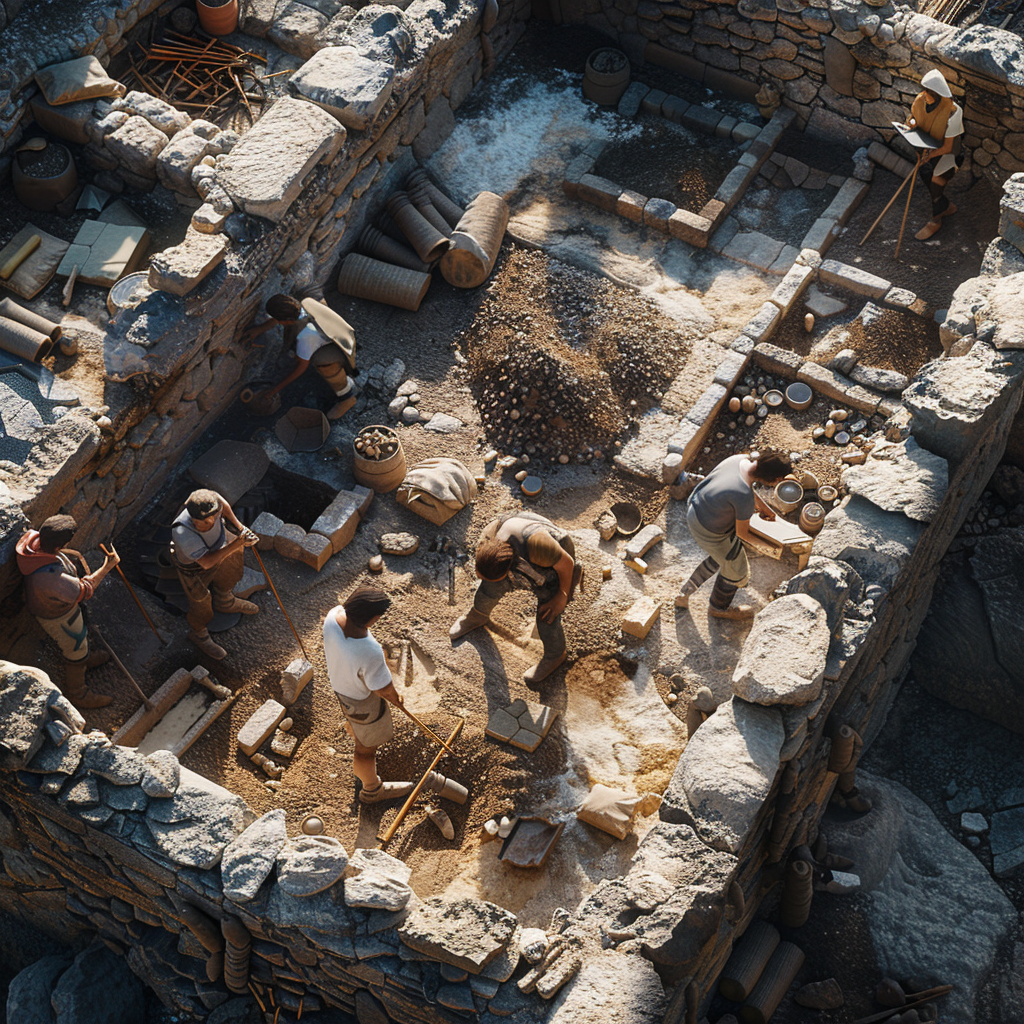
ARCHAEOLOGICAL PROJECTS
Key Benefits
Precise and Detailed Documentation
LiDAR point clouds provide a precise and detailed 3D representation of archaeological sites, even those with complex structures or irregular terrain. This allows archaeologists to create accurate 3D models that can be utilized for analysis, studies, and virtual reconstructions.
Advanced Spatial Analysis
LiDAR point clouds can be employed to perform advanced spatial analysis of archaeological sites, such as identifying patterns of spatial distribution, measuring distances and volumes, and creating elevation maps. This information is essential for understanding the organization and development of archaeological sites.
Visualization and Simulation
The 3D models generated from LiDAR point clouds can be utilized to create realistic visualizations and simulations of archaeological sites. This allows archaeologists to effectively communicate their findings to the public, recreate the original appearance of the sites, and plan conservation and restoration projects.
APPLICATIONS IN ARCHAEOLOGICAL PROJECTS
Documentation of Archaeological Sites
LiDAR point clouds are employed to document archaeological sites of all types, including prehistoric settlements, ancient ruins, lost cities, and historical monuments. This enables archaeologists to create a precise and detailed record of these sites for their study and conservation.
Analysis of Archaeological Structures
LiDAR point clouds are utilized to analyze archaeological structures, such as temples, palaces, fortifications, and dwellings. This allows archaeologists to understand the construction, function, and organization of these structures, and gain insights into the societies that inhabited them.
Study of Archaeological Artifacts
LiDAR point clouds are used to study archaeological artifacts, such as pottery, tools, weapons, and ornamental objects. This enables archaeologists to analyze the shape, texture, and decoration of these objects, and gain information about the manufacturing techniques, use, and cultural significance of the same.
Virtual Archaeology and Augmented Reality
LiDAR point clouds are employed to create virtual archaeology and augmented reality experiences, which allow the public to explore archaeological sites remotely and interactively. This contributes to the dissemination of archaeological knowledge and raising awareness about the importance of cultural heritage preservation.
CASE STUDY EXAMPLES
Machu Picchu Archaeological Site in Peru
LiDAR point clouds were utilized to create a precise 3D model of Machu Picchu, which has allowed archaeologists to study the site’s spatial organization, identify new structures, and better understand the daily life of the Incas.
Valley of the Kings in Egypt
LiDAR point clouds were employed to create 3D models of the tombs of the Egyptian pharaohs, which has allowed archaeologists to study the architecture, decoration, and contents of these tombs without the need to excavate them, thus preserving their integrity.
Colosseum in Rome, Italy
LiDAR point clouds were used to create a detailed 3D model of the Colosseum, which has enabled archaeologists to study the original structure of the monument, identify damages, and plan restoration projects.
LiDAR Mapping, Measurement, and BIM Plans: Precision, Efficiency, and Savings for Your Projects

Green Masters offers innovative solutions for LiDAR-based mapping, measurement, and BIM plans, providing our clients with a fast, efficient, and precise experience for project development.
What is LiDAR and how does it work?
LiDAR (Light Detection and Ranging) is a remote sensing technology that utilizes laser light pulses to measure distances and create high-precision 3D point clouds. This technology enables the capture of minute details of structures, terrain, and objects, providing valuable information for a wide range of applications.
Benefits of LiDAR Surveying for BIM Projects:
LiDAR surveying has transformed the landscape of BIM projects, offering unprecedented millimeter-level precision, comprehensive and detailed data, and efficiency that far surpasses traditional methods. This revolutionary technology empowers project teams to make informed decisions at every stage of development, from planning to execution, optimizing outcomes, and minimizing risks.
Millimeter-level Precision
LiDAR delivers millimeter-level precision, superior to traditional surveying methods, ensuring data accuracy and BIM model reliability.
Efficiency and Time Savings
LiDAR surveying is significantly faster than traditional methods, reducing field time and accelerating project development.
Cost Reduction
LiDAR’s accuracy and efficiency can lead to significant cost reductions compared to traditional methods, optimizing project budgets.
Comprehensive and Detailed Data
The LiDAR point cloud captures a vast amount of detailed information, including structural elements, topography, vegetation, and other environmental features, providing a solid foundation for BIM model creation.
Informed Decision-making
The precise and detailed information provided by LiDAR empowers project teams to make informed decisions throughout the development process, from planning to execution.
Applications of LiDAR Surveying in BIM Projects:
BIM technology empowers project teams to make informed decisions at every stage, from planning to execution, optimizing outcomes and minimizing risks. Its wide applicability in sectors such as construction, civil engineering, architecture, archaeology, and asset management makes it an indispensable tool for driving successful and high-quality BIM projects.
Building, Structure, and Infrastructure Surveying
LiDAR is ideal for capturing the precise geometry of buildings, bridges, tunnels, and other complex structures, facilitating design, construction, and asset management.
Construction Project Planning and Control
LiDAR’s detailed information enables accurate planning of construction projects, optimizing logistics, resource allocation, and time management.
Building Asset Management, Maintenance, and Renovation
LiDAR facilitates the precise inspection of buildings, identifying potential structural issues and enabling efficient maintenance and renovation.
Inspection of Power, Gas, and Telecom Networks
LiDAR allows for safe and efficient inspection of utility networks, identifying potential damage or failures and facilitating their maintenance and repair.
Urban Planning, Infrastructure Management, and Project Development
LiDAR provides valuable information for urban planning, infrastructure management, and project development, enabling informed and sustainable decision-making.
Nuestros levantamientos son fundamentales para proyectos BIM y pueden reducir hasta un 70% del tiempo de inicio de su proyecto.
See how you can save money by using our services. Contact us today for more information and a free quote.
Electrical and Mechanical Route Surveying Services for BIM Projects

Once our team completes the LiDAR scan, they have captured a dense point cloud of the electromechanical route’s path. This point cloud serves as a digital representation of the existing environment, providing a wealth of information for further analysis and integration.
The use of BIM projects for electrical and mechanical routes with LiDAR technology offers an innovative and efficient solution for the design, modification, inspection and maintenance of said routes.
Benefits of LiDAR for Electrical and Mechanical Routes
Precision to the Millimeter for Flawless Design
Our LiDAR surveying service captures every detail of the electromechanical route with millimeter precision, eliminating errors and ensuring a precise design.
Immersive 3D Models for Strategic Planning
Gain a comprehensive view of the project with high-quality, detailed 3D models that integrate the electromechanical route into the context of the overall design, facilitating strategic planning and informed decision-making.
Design Optimization and Cost Reduction
Identify and eliminate design conflicts before construction, reducing redesign costs and project delays.
Why Choose Green Masters for Your Projects?
At Green Masters, we are passionate about driving our clients’ success through cutting-edge 3D surveying and modeling solutions. Our team of highly qualified experts provides you with:
- Global Experience: We have led a wide range of projects in diverse countries, including the United States, Costa Rica, Mexico, El Salvador, Nicaragua, Panama, Bolivia, Argentina, Uruguay, the United Kingdom, Norway, France, Saudi Arabia, Dubai, Guatemala, and many more.
- Deep Understanding of Your Needs: We possess extensive industry experience and the ability to thoroughly comprehend your specific needs.
- Customized Solutions: We create tailored solutions for each project, ensuring that they perfectly align with your requirements and objectives.
- Outstanding Results: We are committed to delivering exceptional results that exceed your expectations and contribute to your project’s success.
- Support from Start to Finish: We accompany you through every stage of the process, from initial planning to the final delivery of results.
- Constant Communication: We maintain open and transparent communication with you to ensure you are informed at all times about the project’s progress.
- Focus on Your Goals: We prioritize your objectives and work closely with you to achieve them effectively.
Contact Us
At Green Masters, we are not just a service provider; we are a strategic partner for your project’s success. Contact us today and discover how our high-quality 3D surveying and modeling solutions can propel your business to new heights.